Our reservation was for 2PM, but we decided to leave a little early. The 100 mile drive was suppose to be very scenic, plus there was Thunder Bird (water)Falls about 2/3 the way there that was only about one mile off Glenn Highway(Alaska route 1).
Wednesday, July 2, 2014
Alaska Part 2: Hiking the Matanuska Glacier
We planned one of our days in Anchorage to go hiking on the Matanuska Glacier. It is about 2 hours (100 miles) NE of Anchorage. It is 27 miles long and 4 miles wide (108 sq. miles). It is the largest glacier in the U.S. accessible by car. Sounds big, but the biggest is Bering Glacier at 2,000 sq. miles (it's about 300 miles NE of Anchorage near the Canadian border). I was also surprised to hear that glaciers make up 5% of Alaska's land area.
Our reservation was for 2PM, but we decided to leave a little early. The 100 mile drive was suppose to be very scenic, plus there was Thunder Bird (water)Falls about 2/3 the way there that was only about one mile off Glenn Highway(Alaska route 1).
Finally, a gnome path !
Teeny-weeny white flower (1/4" wide).
This bush was about 6' tall with the flowers about 5."
Thunder Bird Falls - 70' drop.
Close-up.
Hatcher Pass. A few miles past Thunder Bird Falls along the Matanuska River. Named after a miner/prospector from the early 1900's. Looking north.
Looking south.
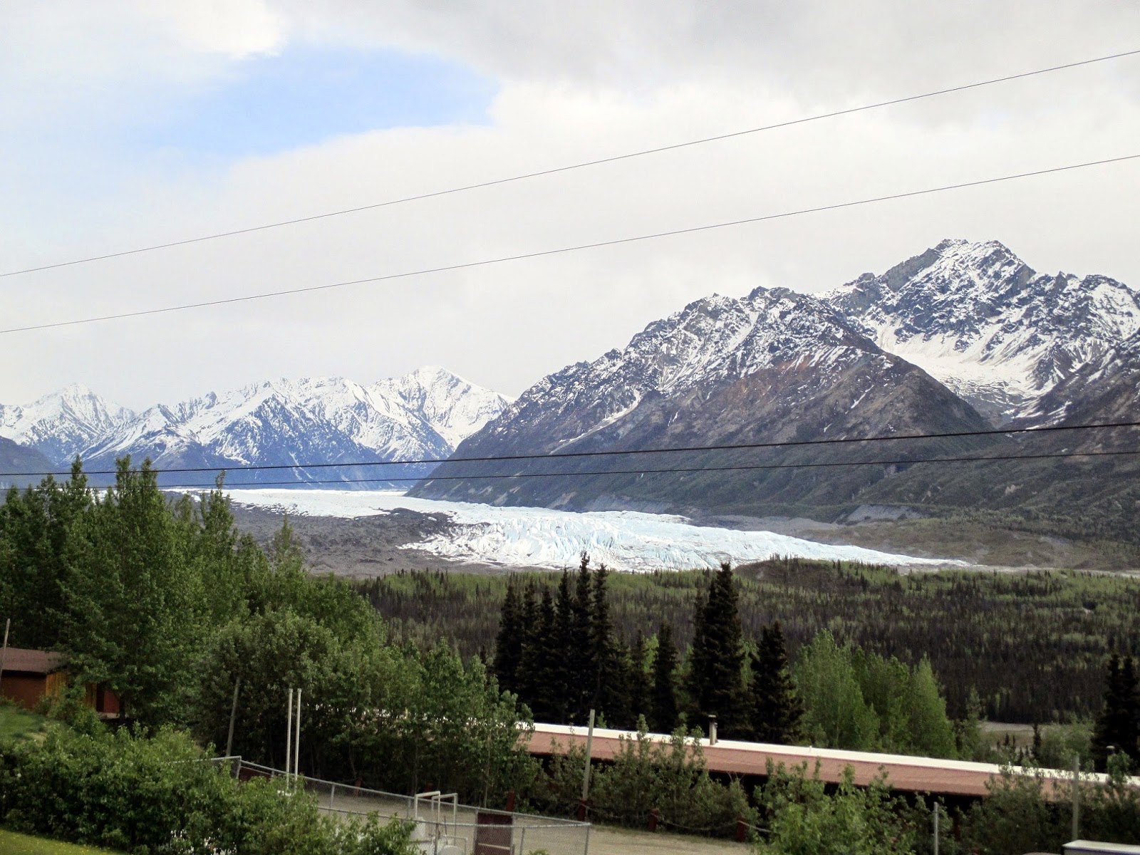
The Matanuska Glacier.
The terminus of the glacier. Where we did the hike.
The outfitter we used. You can just see the glacier in the background.
Looks close, but probably a 1/2 mile away.
On the glacier looking back; in the middle of the photo is a building that we started from (it was another 2 mile drive from the outfitters building).
Ice climbers. We decided to do just the walk.
Moving on !
Still have a ways to go.
Ben, our guide, showing us very clear glacial pool.
Getting to the good parts.
Another good view looking back to where we started. About in the middle of the photo, you can just see 2 'dots' on the top of the glacier: they are people. Just to the left of them, you can barely make out the building we started from.
Mother and son pose on the glacier.
Didn't have anything to show how big this is. Probably 400' to 500' tall.
A small bit (maybe a foot across) of clear blue glacial ice. Glacial ice is so clear because all the air bubbles have been forced out of the ice due to the tremendous pressure put on the snow.
The 2 hikers give you an idea of the size of this part of the glacier.
It was just a cool experience.
Posing solo in front of a small glacial pond.
Our reservation was for 2PM, but we decided to leave a little early. The 100 mile drive was suppose to be very scenic, plus there was Thunder Bird (water)Falls about 2/3 the way there that was only about one mile off Glenn Highway(Alaska route 1).
Tuesday, July 1, 2014
Alaska Part 1: Anchorage
Earlier this year, we decided to take our next trip to Alaska. We planned it for 11 days (May 28th through June 11th): 2 travel days, 2 days in Anchorage and 7 days on a cruise (from Whittier, Alaska to Vancouver, Canada).
A few miles SW of downtown Anchorage was Flattop Mtn., Alaska's most popular peak to climb. It starts at 2,256' and goes to 3,550'. It's a 3 mile round trip and takes about 2 1/2 hours. It is rated as moderate, but the last third had to be strenuous; any harder and only mountain goats could have done it. But, my son and I made it !! In the center of the photo is the start of the trail from the parking lot with the mountain in the distance
Posing on the easy part
A little winded !!
Made it to the top
The 3,550' marker
Anchorage from Flattop Mtn.; it is just right of center on the Cook Inlet (looking NE)
Another view looking east
A view of near-by mountains from the top
Evergreen along the trail with purple pine cones. They were only about a 1/2 inch long.
Tiny little flowers ; barely a 1/4 inch wide
Part of downtown Anchorage
The Anchorage Museum. It had really good exhibits on Alaska Natives, Alaska history from the last Ice Age to present and pollution (mainly in the worlds waters)
A remnant of the earthquake in Anchorage in 1964. Where the person is walking used to be at the same level as the parking lot
While on a trolley tour, the driver took us down a side road where moose sitings usually occur. As you can see, there was a mama moose. What you don't see was her 2 week old baby. Just as we got close enough to get a photo of the baby, it ran across the street into a wooded area.
Baby moose is in there, but well camouflaged.
Everywhere you look, there are these small private planes 'docked' on the water. Our trolley driver told us that Alaska has 1/4 of all these types of planes in the U.S.
Even more
We took a chance going that early - most 'touristy' places do not open until May 15th. As it turned out, it was not that cold. Daytime temperatures ranged from about 48° to 59° (for the whole trip). It was cloudy and the coolest the 2 days we were in Anchorage, but as we continued south, the temperature slowly increased and the sun came out more.
I'm going to create 6 posts for the trip: One for Anchorage, one for a glacier walk, one for a train ride and glacier and 3 for the cruise (Skagway, Juneau and Ketchikan [and Vancouver]).
Subscribe to:
Comments (Atom)


