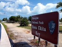
It is 173,000 acres (270 sq. miles), but only 5% of that is land; just a small band along the mainland and a few barrier islands. As you will see, the only way to get to the islands is by boat. There are only a few places that are even developed (I use that term loosely), so there is not much to see. The island we went to, Boca Chita Key, is the northern most barrier island (if you look on the map below, there are 3 islands between 'Bay' and 'National.' Boca Chita Key is the 'top' one). Boca Chita Key was developed by a millionaire back in the 1930's.
Thursday, March 29, 2012
Biscayne National Park (Florida)
While we were at Marco Island, we decided to visit this national park. We had seen it on the map, but never got around to go see it. It's about 120 miles east of Marco Island. The 2nd 'photo' below shows you where it is in relation to Miami.
It is 173,000 acres (270 sq. miles), but only 5% of that is land; just a small band along the mainland and a few barrier islands. As you will see, the only way to get to the islands is by boat. There are only a few places that are even developed (I use that term loosely), so there is not much to see. The island we went to, Boca Chita Key, is the northern most barrier island (if you look on the map below, there are 3 islands between 'Bay' and 'National.' Boca Chita Key is the 'top' one). Boca Chita Key was developed by a millionaire back in the 1930's.
Just to show you where it is located. I didn't even know it existed until about a year ago.
Enjoying the boat ride.
Approaching the harbor on the island.
A 'lighthouse' that does not work and never worked; it doesn't even have a light.
You can just make out Miami 10 miles away on the horizon.
A red bellied woodpecker.
The GEICO gecko has relatives everywhere.
Looking at the 'lighthouse' from the other side of the harbor.
Coconut palms. The Park Service volunteer told us that several people each year get killed by falling coconuts.
A peaceful lagoon.
Yours truly at another one.
The water is pretty.
A power plant along the coast of the park. On the map, look just below the 'V' in Visitor. The Park boundary goes out a little bit into the bay. To the left of the boundary line is where the power plant is located.
Heading back. The buildings with the red roofs belong to the Visitor center.
A red mangrove plant. The 'spikes' coming out of the ground to the left of the plant are used to get CO2 to the plant.
A double crested cormorant. It can be 2' to 3' in length with a wing span of 4.'
It is 173,000 acres (270 sq. miles), but only 5% of that is land; just a small band along the mainland and a few barrier islands. As you will see, the only way to get to the islands is by boat. There are only a few places that are even developed (I use that term loosely), so there is not much to see. The island we went to, Boca Chita Key, is the northern most barrier island (if you look on the map below, there are 3 islands between 'Bay' and 'National.' Boca Chita Key is the 'top' one). Boca Chita Key was developed by a millionaire back in the 1930's.
Friday, March 23, 2012
We go cruising - again !
About a month or so ago, we decided to take another cruise, this time to the southern Caribbean. We wanted to make sure it would be warm enough when we went.
We went with Princess Cruise lines again, leaving Ft. Lauderdale on the 17th. The first stop was an island in the Bahamas that they own: Princess Cays on the island of Eluethera. We had a day at sea before we landed at Curacao on Tuesday, Aruba on Wednesday, 2 days at sea and landing back at Ft. Lauderdale on Saturday (24th). As you will see by the photos, we had very good weather the whole week.
Part of our cruise ship; couldn't get far enough away to get the whole ship in the photo.
The 'cruise ship' part of Port Everglades in Ft.Lauderdale.
Part of the port looking south from the ship.
Fleta is ready to cruise (we splurged and got a balcony).
Looking north at the port; I thought we were going to get rained on just as the ship left.
One of two of the largest cruise ships, Royal Caribbean's 'Oasis of the Seas.' Holds over 6,000 passengers and 2,100 crew members. Our 'puny' ship only held 3,600 passengers and 1,200 crew members.

We got a warm send off by the Coast Guard. Yes, that is a large caliber machine gun on the front of the boat.
Sunset on the high seas.
A little breakfast on our balcony.
A couple got married while on the cruise.
On Princess Cay. Lots of people.
Mileage markers with the ship in the background.
Another view of all the people that went ashore.
Where's Caroline ?
While at sea, I stepped onto the balcony to be greeted by this rainbow. This was the first time I had seen a rainbow end to end...
Right end...
and the left end. Notice something missing ? No pot of gold at either end. I'm sure they were there when the rainbow first appeared, but the pots must have sunk before I saw the rainbow.
We land at the capital of Curacao, Willemstad.
A pontoon bridge to the main downtown area.
Colorful buildings of downtown.
Some shops down a side street. Unless you were interested in jewelry, there wasn't much variety in shopping places. We went back to the ship after maybe 2 hours in town.
The capital of Aruba, Oranjestad.
Looking north of the capital.
We took a 2 hour bus ride to the northern part of the island. This was one of the stops; a small hill of rocks that gave a good view of the entire island.
A little windy up top.
Looking south.
A cashew tree.
The rock 'mountain' we climbed.
An aloe plantation further up the road.
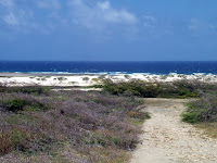
Looking north from the northern tip of the island.
California lighthouse. It was named after a steamship named California that sunk off the coast in 1891.
One of the main streets in the capital.
Junk shops, ooops, I mean souvenir shops.
Adventure on the high seas. For all on board, except one. Someone had a medical emergency on the way back to Florida and had to be airlifted off the ship by the Coast Guard. The 'speck' is the helicopter.
They had to lower a rescue basket just like you see on TV. While the passenger was being loaded in the basket, the helicopter circled around the ship.
In port Saturday morning. That ship was a little smaller than ours. Notice how small the port area is. This ship came into the middle and did a 180 and backed into its berth just to the right. See next photo.
It has several thrusters that make tugboats unnecessary.
Sunrise and the end of our cruise.
We went with Princess Cruise lines again, leaving Ft. Lauderdale on the 17th. The first stop was an island in the Bahamas that they own: Princess Cays on the island of Eluethera. We had a day at sea before we landed at Curacao on Tuesday, Aruba on Wednesday, 2 days at sea and landing back at Ft. Lauderdale on Saturday (24th). As you will see by the photos, we had very good weather the whole week.

Some shops down a side street. Unless you were interested in jewelry, there wasn't much variety in shopping places. We went back to the ship after maybe 2 hours in town.

Subscribe to:
Comments (Atom)


