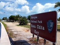
It is 173,000 acres (270 sq. miles), but only 5% of that is land; just a small band along the mainland and a few barrier islands. As you will see, the only way to get to the islands is by boat. There are only a few places that are even developed (I use that term loosely), so there is not much to see. The island we went to, Boca Chita Key, is the northern most barrier island (if you look on the map below, there are 3 islands between 'Bay' and 'National.' Boca Chita Key is the 'top' one). Boca Chita Key was developed by a millionaire back in the 1930's.
Thursday, March 29, 2012
Biscayne National Park (Florida)
While we were at Marco Island, we decided to visit this national park. We had seen it on the map, but never got around to go see it. It's about 120 miles east of Marco Island. The 2nd 'photo' below shows you where it is in relation to Miami.
It is 173,000 acres (270 sq. miles), but only 5% of that is land; just a small band along the mainland and a few barrier islands. As you will see, the only way to get to the islands is by boat. There are only a few places that are even developed (I use that term loosely), so there is not much to see. The island we went to, Boca Chita Key, is the northern most barrier island (if you look on the map below, there are 3 islands between 'Bay' and 'National.' Boca Chita Key is the 'top' one). Boca Chita Key was developed by a millionaire back in the 1930's.
Just to show you where it is located. I didn't even know it existed until about a year ago.
Enjoying the boat ride.
Approaching the harbor on the island.
A 'lighthouse' that does not work and never worked; it doesn't even have a light.
You can just make out Miami 10 miles away on the horizon.
A red bellied woodpecker.
The GEICO gecko has relatives everywhere.
Looking at the 'lighthouse' from the other side of the harbor.
Coconut palms. The Park Service volunteer told us that several people each year get killed by falling coconuts.
A peaceful lagoon.
Yours truly at another one.
The water is pretty.
A power plant along the coast of the park. On the map, look just below the 'V' in Visitor. The Park boundary goes out a little bit into the bay. To the left of the boundary line is where the power plant is located.
Heading back. The buildings with the red roofs belong to the Visitor center.
A red mangrove plant. The 'spikes' coming out of the ground to the left of the plant are used to get CO2 to the plant.
A double crested cormorant. It can be 2' to 3' in length with a wing span of 4.'
It is 173,000 acres (270 sq. miles), but only 5% of that is land; just a small band along the mainland and a few barrier islands. As you will see, the only way to get to the islands is by boat. There are only a few places that are even developed (I use that term loosely), so there is not much to see. The island we went to, Boca Chita Key, is the northern most barrier island (if you look on the map below, there are 3 islands between 'Bay' and 'National.' Boca Chita Key is the 'top' one). Boca Chita Key was developed by a millionaire back in the 1930's.
Subscribe to:
Post Comments (Atom)


No comments:
Post a Comment